How Do You Track Your Rides Without an App?

Aniceta Werknesh

Just Joined
Jan 22, 2025
1
0
Hi everyone,
I recently started using an electric bike for my daily commutes and weekend adventures, and I’ve been absolutely loving it. However, I’ve run into a bit of a dilemma, and I’m curious to hear how others have dealt with something similar.
Here’s the situation: I’m trying to track my rides to get a better sense of my routes, distances, and even my average speed. But here’s the catch—I don’t really want to use an app on my phone for this. I know there are lots of popular cycling apps out there, but I prefer something a bit more straightforward and independent from my phone. My rides are a bit of an escape for me, and I don’t want to be tied to a screen or worry about battery life.
One idea that caught my attention is using a simple cycling tracker tool. For those unfamiliar, a cycling tracker, often referred to as a digital cycling distance log tool, is a compact device designed to monitor and record essential data from your rides. Unlike apps that rely on smartphones, these tools are standalone gadgets that can track things like distance traveled, riding time, and sometimes even speed and elevation. They often come in both GPS-enabled and non-GPS options, giving riders the flexibility to choose based on their needs. What I love about the concept is how it allows you to stay focused on the road while still gathering meaningful data about your rides.
I’ve found that there’s such a huge variety of these tools out there, and I don’t know where to start. Some focus on GPS tracking, others are purely mechanical, and then there are the ones that sync with other devices like heart rate monitors. I’d love to hear your experiences and what you’d recommend for someone like me who’s just looking for something simple and reliable.
For those who use cycling trackers, how do you incorporate them into your rides? Are they easy to set up and use without a lot of maintenance? And if you’ve chosen not to use a tracker, what’s your approach to keeping track of your cycling stats?
I’m also curious—do you think tools like these add to the cycling experience, or do they sometimes take away from the simplicity and joy of just being out on the road?
Thanks in advance for your advice and tips! I’d love to hear what’s worked for you and any creative solutions you’ve come up with.
Looking forward to your replies!
 

Ocsid

Esteemed Pedelecer
Aug 2, 2017
458
272
81
Hampshire
Use a very dated Garmin Etrex Vista HCx [ like LINK ], from which I can download the track to my PC, here I still use "Memory Maps".

The Etrex I have uploaded with OpenStreet Maps, so have a very detailed display of the route with my progress.
 

Az.

Esteemed Pedelecer
Apr 27, 2022
2,164
968
Plymouth
I’m also curious—do you think tools like these add to the cycling experience, or do they sometimes take away from the simplicity and joy of just being out on the road?
Take away.
I don't feel the need to track anything nor to lock myself to yet another screen. Live the moment, breathe the air, listen to the sound of nature.
 

matthewslack

Esteemed Pedelecer
Nov 26, 2021
2,074
1,470
Not enough roads in Scotland to need a tracker!
 

saneagle

Esteemed Pedelecer
Oct 10, 2010
7,280
3,361
Telford
I don't think special gadgets are needed. A simple smart watch, like the Huawei GT2 or GT4 does all that and much more.

Even when you use a smartphone, you're not tied to the screen. You just press the start button, then put the phone in your pocket. You can study the results when you get home.

Finally, a lot of cyclists like to use cameras to record their rides in case of incidents. Some of them have sophisticated trackers included that have all the information you mentioned. When you download the video, you can also download the tracking info to your PC.
 

Ocsid

Esteemed Pedelecer
Aug 2, 2017
458
272
81
Hampshire
I like a record of certain "exploratory" type rides I make, where did I actually go.
But then I like maps and I like exploring, plus I like and am comfortable with technology.
In no way does a tracker in your pocket, panier or rucksack need to rob you of any of the enjoyment of being out, you don't even need to download your track if there is no interest in that ride.
Journeys exploring the matrix of for example French off road tracks, without the benefit of a track of where you actually found a way through would be quite a mental challenge without. Even much of the mapping does not necessarily have that level of detail. A plus with my Etrex is you can find where you actually are, as opposed to where you think you are!
There are many other solutions.
 

portals

Esteemed Pedelecer
Jul 15, 2022
724
209
Unless you've turned it off google will track your every movement and you can view your Timeline from google maps.
 

guerney

Esteemed Pedelecer
Sep 7, 2021
11,650
3,299
Finally, a lot of cyclists like to use cameras to record their rides in case of incidents. Some of them have sophisticated trackers included that have all the information you mentioned. When you download the video, you can also download the tracking info to your PC.
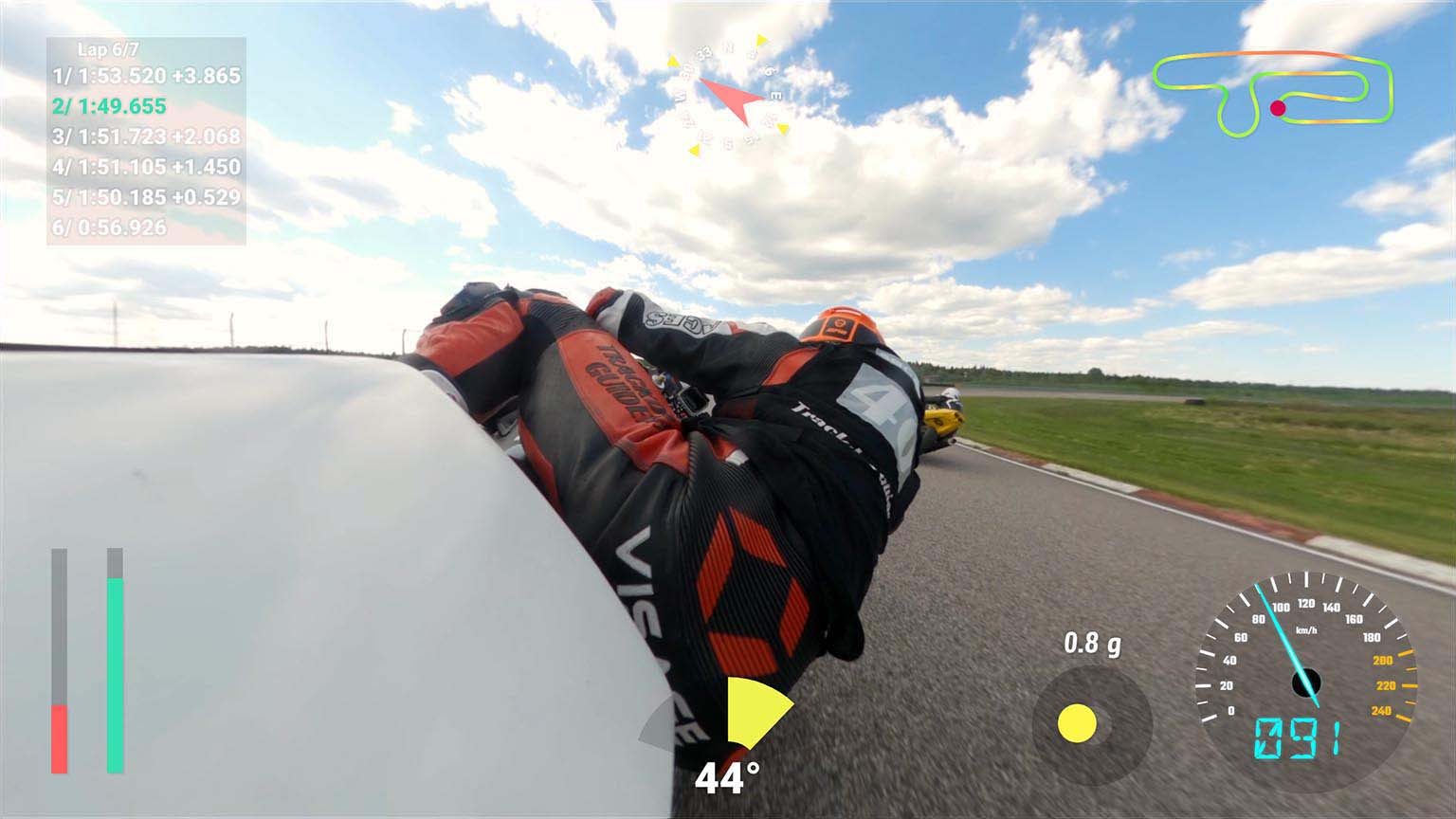
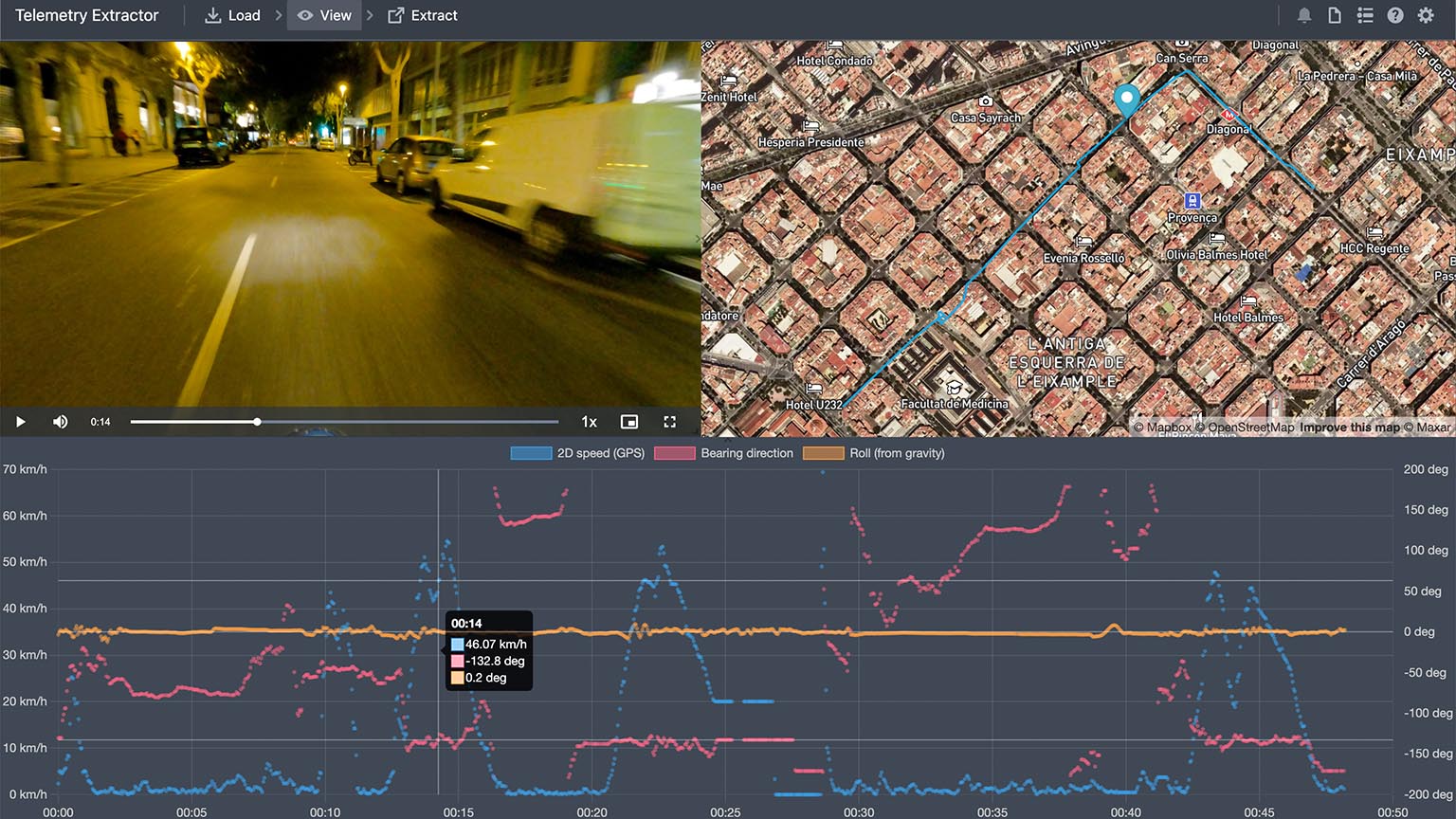
I record all my rides with GPS on my GoPro Hero 7 Black enabled, for proof in case I need to sue someone to homelessness. I haven't bothered to display it, but my GoPro Hero 7 Black records GPS data with all video - it can be extracted, producing an .AVI file with a green background using this:


...which can be chromakeyed as an overlay using a video editor to show altitude and speed etc. Use Handbrake to convert the .AVI file to a format (free) Davinci Resolve or other video editors such as Sony Vegas can import - I've done this, works well.


There are other GPS data extractors which can export to Google Earth and other formats. The easy to use extractors are expensive, the fiddly ones are free. Things which save you money cost you time.

GoPro's official GPMF parser

https://github.com/juanmcasillas/gopro2gpx

https://github.com/maza70/ZGCam

https://github.com/hyaguchi947d/gopro_gps_ui

https://github.com/progweb/gpx2video


https://goprotelemetryextractor.com/free/


Overlay using GoPro's Quik app, showing a basic route map:


If you're interested, you can buy one second hand for £120 here, with a 2 year guarantee.

https://uk.webuy.com/product-detail?id=0818279023077B&categoryName=CAMCORDERS&superCatName=ELECTRONICS&title=&queryID=F15C3AC36E4E7D2AEA769694158C842F&position=1


You should buy new original batteries, I got mine on ebay.

https://www.ebay.co.uk/itm/314302244157


V9 £145.00:

https://uk.webuy.com/product-detail?id=818279025057B&categoryName=CAMCORDERS&superCatName=ELECTRONICS&title=&queryID=F73AA09ABB87A0CD1437328A3A71F211&position=2
 
Last edited:

richtea99

Esteemed Pedelecer
May 8, 2020
443
286
If you want to stay offline but have some stats for your own consumption, then an old school cycle computer like a Mity Cateye will give you speed, distance, etc.

> I’m also curious—do you think tools like these add to the cycling experience, or do they sometimes take away from the simplicity and joy of just being out on the road?

They take away from the experience, but I suspect it's different if you're riding primarily for excercise, not pleasure.
 

guerney

Esteemed Pedelecer
Sep 7, 2021
11,650
3,299
How Do You Track Your Rides Without an App?
With low cost devices, either a phone or desktop app is going to be involved at some stage.

My old Dell Axim Windows CE PDA with phased array GPS antenna did the job great, even in remote areas far far away from phone masts. Still might again, if the battery holds a charge.

Here's a cheap GPS data logger, which according to reviews has ropey software incompatible with Windows 10. There are more expensive devices which may do a better job:

https://www.amazon.co.uk/Renkforce-373686-GT-730FL-S-Data-Logger/dp/B005OJUKAW


Looks like there are Jesusphone apps for tracking pleasantly aimless wanderings about all over the place:


I don't have a Crapple, so may give this Android version a whirl if bored someday:


Google Earth seemingly can import GPX format from cameras and phones etc. so you can see where on earth you've been.


I’m also curious—do you think tools like these add to the cycling experience, or do they sometimes take away from the simplicity and joy of just being out on the road?
Provided I've remembered to charge my GoPro Hero 7 Black's batteries, it's no trouble at all - I simply press one button and forget about it (I sometimes have to check and change settings, immediately after changing battery - this bug may have been squished in newer versions). The camera is affixed to the jawguard of my helmet, doesn't get in the way in any way. If I need to sue someone to death for damages, or find out where the heck I've been all this time, the data is there in audiovisual and GPS formats from the same device and within the same file.
 
Last edited:

BazP

Esteemed Pedelecer
Oct 8, 2017
366
175
75
Sheffield
Use a very dated Garmin Etrex Vista HCx [ like LINK ], from which I can download the track to my PC, here I still use "Memory Maps".

The Etrex I have uploaded with OpenStreet Maps, so have a very detailed display of the route with my progress.
Like you, I use MemoryMap and also OS maps for making routes and transferring the GPX files to my phone but I would be wary of making routes on Open Street Map as not all paths are public paths or bridleways. There are some dotted tracks locally that go through peoples gardens.
 

Bikes4two

Esteemed Pedelecer
Feb 21, 2020
1,037
445
Havant
But here’s the catch—I don’t really want to use an app on my phone for this. I know there are lots of popular cycling apps out there, but I prefer something a bit more straightforward and independent from my phone. My rides are a bit of an escape for me, and I don’t want to be tied to a screen or worry about battery life.
> From your requirements you will require a second device of some sort (other than your phone).
> If going for something like a Garmin or similar device, then there is a learning curve to this, hardly "a bit more straight forward" to using the phone IMHO
> As for worrying about battery usage, how long (in time) are you wanting to record your journeys for? If longer than a few hours then something powered by batteries might be best but most modern phones with the right app shouldn't cause any problems.
> If you truly want something independant from your phone, buy a second phone (cheap and used) and use the GPS function on it (no SIM card necessary) - that's all a bit of a faff of course but the 'learning curve' will be simpler than a Garmin et al.
> Lots of app - I use the one in the pic for when I want to look at a ride I'm to do - I set it recording at the start of the journey and then put it in my pocket until finishing the ride. If I want more stats such as elevation then it is straight forward to take the recorded GPX file (on the phone) and import it into another app (also on the phone) - Simples as they say.
61863
 

thelarkbox

Esteemed Pedelecer
Aug 23, 2023
1,309
405
oxon
Sounds like an ideal my first arduino project ;) spend a bit more on a good gps sensor for accuracy and spend a sunday evening tinkering ;)
 

jimriley

Esteemed Pedelecer
Jun 17, 2020
607
405
I use Google Fit on Android to track my rides and walks, there's a basic mode by default and a more accurate mode, select for walk/cycle. It does average speed, altitude etc. I don't need to export anything, I've no need. I generally just check It out when I've got home. It just works while the phone is on anyway in a little crossbar bag. As for battery life, I fitted a 36v feed in usb socket on the handlebars so I've no worries on that front. I do use phone for navigation occasionally, via Google maps/cycle. It knows the city cycleways etc.
It's all part of google so nothing extra to pay for.
 

guerney

Esteemed Pedelecer
Sep 7, 2021
11,650
3,299
A few years ago, because I was always wondering how to get home from cellphone dead zones, and my trusty old Dell Axim X5 PDA with GPS satellite navigation (exclusively, no cellular) was getting long in the tooth... one Black Friday, I bought a Sygic app lifetime license. Unfortunately, they've since switched to a monthly subscription pay forever model, which costs more per month than I paid for my lifetime license. The only truly great Black Friday and Xmas deals are for software. All massive maps are downloaded for use offline, enabling navigation without internet, and it records your meandering route for later reference, with distance travelled and time, but sadly there's no altitude info, because it's been created for motorbikes and cars etc. I've learned to be vigilant using it when cycling, because it kept leading me onto motorways. However, waypoints can be set to alter whatever route it plans, and you can plan routes manually by pointing at points on the map at any point.


Last edited: